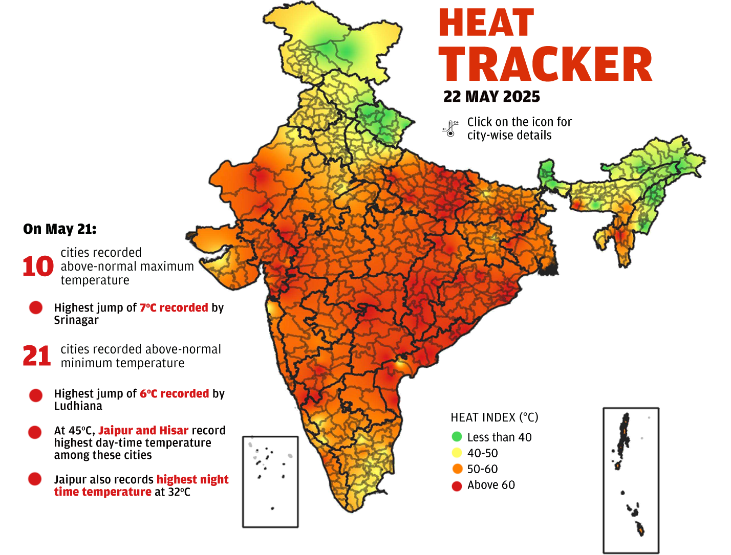
Note: Data for capital cities of 27 states (data not available for Goa) and 8 union territories. In certain states where data is not available for the capital city, data for one of the largest cities has been used. In Haryana and Punjab, data is shown for Hisar and Ludhiana, respectively; Chandigarh's data is shown separately. In the case of Jammu and Kashmir, data is shown for both the capital cities of Jammu and Srinagar.
Source: India Meteorological Department (IMD)