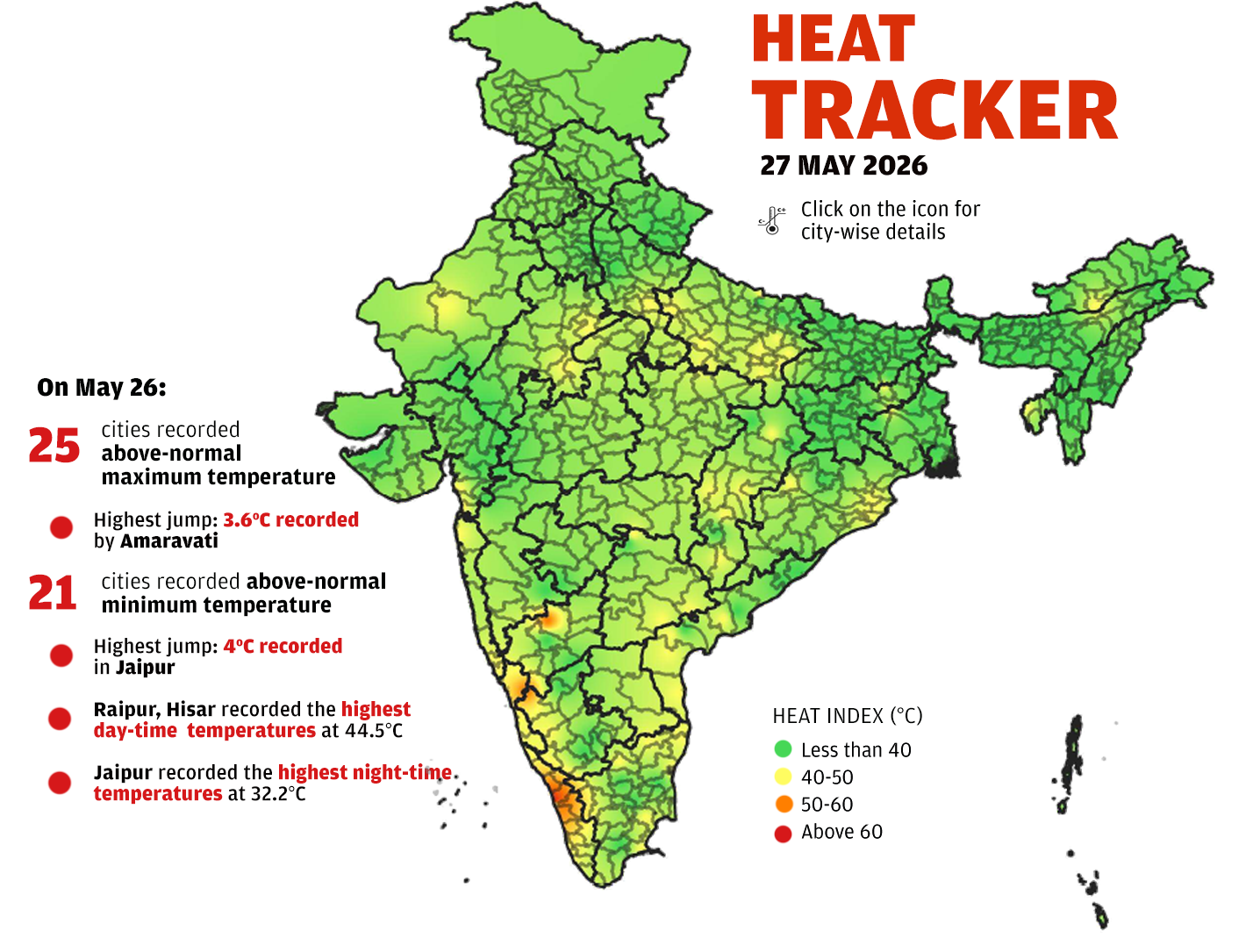
Note: Data covers the capital and major cities of 28 states and 8 union territories. In states where capital city data is unavailable, data for one of the largest cities was used. In Haryana and Punjab, data is shown for Hisar and Ludhiana, respectively. For Jammu and Kashmir, data is shown for both capital cities: Jammu and Srinagar. Data for Chandigarh and Kohima was not available for 26/05/26
The India 'Heat Index' map is sourced from IMD which is experimenting
on a heat index. The map shows the apparent/feel-like temperature (the
impact of humidity on high temperature) for humans. This can be used
as an indication of human discomfort.
Source: India Meteorological Department (IMD)